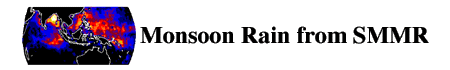
- SMMR Monsoon
- Climate
- Amplitudes and Phases
- Data Set Overview
- Sponsor
- Original Archive
- Future Updates
- The Data
- Characteristics
- Source
- The Files
- Format
- Name and Directory Information
- Companion Software
- The Science
- Theoretical Basis of Data
- Processing Sequence and Algorithms
- Scientific Potential of Data
- Validation of Data
- Contacts
- Points of Contact
This study presents a new climatology of monsoon rainfall over the Indian and West Pacific Oceans. It uses a generalized version of the Wisconsin scheme (Hinton et al., 1992) to retrieve rain rate from the Pathfinder set of Nimbus-7 Scanning Multichannel Microwave Radiometer (SMMR) brightness temperatures (Njuko et al., 1995). The scheme yielded monthly rain rate for open-ocean boxes one-degree in latitude by one degree in longitude from October 1978 through August 1987. There are a total of 104 data months since April, May and June of 1986 are missing. These rain rates were analyzed for structure, behavior and change. They also were compared with rain rates measured by gauges for monsoon analysis.Sponsor
The preparation of this data set for distribution on the Goddard DAAC Research Forum is funded by NASA's Earth Science enterprise. The data are not copyrighted; however, we request that, when you publish data or results using these data, please acknowledge as follows:The authors wish to thank D. W. Martin, B. B. Hinton and K. W. Bywaters (Space Science and Engineering Center, University of Wisconsin-Madison) for the production of this SMMR monsoon rainfall data set. They also thank the Distributed Active Archive Center (Code 902.2) at the Goddard Space Flight Center, Greenbelt, MD, 20771, for preparing these data in the present format and distributing them. These activities were sponsored by NASA's Earth Science enterprise.Original Archive
This data set was produced by D. W. Martin, B. B. Hinton and K. W. Bywaters (Space Science and Engineering Center, University of Wisconsin-Madison, 1225 West Dayton Street, Madison, WI 53706. This was done under National Aeronautics and Space Administration Grant NAGW-3641Future Updates
No future updates of this data are planned at this time.
The monthly rain data set consists of 104 equal-sized files. Each is 62,586 bytes, resulting in a total size just under 7.2 Mbytes. Additionally there are 12 files consisting of multi-year means for each month and 7 yearly means for each complete year in the dataset plus a multi-year annual mean. In the case of incomplete years, no annual file is given. In addition, a harmonic decomposition was performed on the monthly mean rainfall data to produce 4 additional files containing annual and semiannual components. Thus there are 128 files in the complete Monsoon data collection.
- Parameters, Units
Parameter Range Units monthly Rainfall Rates 0. to 999. Micrometers per hour Annual Amplitudes 0. to 355. Semiannual Amplitudes 0. to 131. Phase 0. to 6.27 radians
- Temporal Coverage: October 1978-August 1987
- Temporal Resolution: monthly, annual and 7-year means
- Spatial Coverage: 30.5S to 30.5N degrees latitude and 29.5E to 200.5E longitude
- Spatial Resolution: 1 degree x 1 degree
Nimbus-7 and the SMMR Instrument:
The Nimbus-7 spacecraft was launched October 26, 1978, into a Sun-synchronous polar orbit with local noon (ascending) and local midnight (descending) equator crossings. The orbital period was approximately 104 minutes and the equator crossings were separated by 26.1 degrees in longitude. The SMMR instrument was forward viewing and scanned 390 km to either side of the orbital track. Because of limited spacecraft power, it was operated every other day so that the entire globe was mapped twice every 6 days. SMMR measured microwave radiation from Earth's surface and surrounding atmosphere at five frequencies (6.6, 10.7, 18, 21, and 37 GHz) in both horizontal and vertical polarizations. The band width at each frequency is 250 MHz. A combination of oval instantaneous fields of view (IFOVs) and the integration times of the radiometers yields roughly circular beams spots with the following diameters: 6.6 GHz-148 km, 10.7 GHz-91 km, 18 GHz-55 km, 21 GHz-46 km, and 37 GHz-27 km. The antenna beam scan lies along a conical surface with a 42 degree half angle so that the distance to the surface of Earth is constant over the scan. The angle of incidence at Earth's surface is approximately 50 degrees (Oakes et al., 1989). For additional details concerning the SMMR instrument the reader is referred to Gloersen and Barath (1977). In 1987, the SMMR showed signs of instrument failure. From August 1987 until it was turned off in July 1988, the SMMR operated in a nonscanning mode.
The instrument was calibrated in flight by observing a hot and a cold reference source. The radiometer outputs are converted to antenna temperatures using the hot reference and the cold space reference measurements and then corrected for antenna pattern effects to obtain brightness temperatures.
For the SMMR instrument, the different polarizations are sampled during successive half scans for all frequencies except 37 GHz. This means that the IFOVs for the vertical and horizontal polarizations do not coincide. Assuming that the antenna temperatures vary smoothly over the extent of a cell, the collocated measurements can be approximated by interpolating the missing channel values from the FOV surrounding the subject FOV.
The Pathfinder SMMR Brightness Temperatures:
As a Pathfinder project, NASA's Jet Propulsion Laboratory (JPL) recently reprocessed the entire record of SMMR observations. In part JPL undertook the reprocessing to "remove (or reduce) known calibration anomalies that existed in earlier versions of the data..." (Njoku et al., 1995). As part of this reprocessing, it reworked the data into swath format. Channel by channel, JPL interpolated brightness temperatures to the location of the footprint of a reference channel. For the reference channel JPL chose 37 GHz (vertical polarization). JPL organized the remapped, recalibrated data by orbit. These Pathfinder brightness temperatures were used in the rain rate study discussed here. .
Each file represents a latitude-longitude grid of mean rain rates. Files for a specific month in a specific year use the date (see section below) designator YYMM. File which contain the mean rain rate for an entire year use the date designator MM. There are also monthly climate files averaged over multiple years (1979-1986), which use the date designator MM, while no date designator is the average annual mean rain rate.
In addition to the monthly and annual grids there are analysis grids in similar format representing the phases and amplitudes of the annual and semiannual components of the rain rate. The amplitude grids use the parameter designators amp1 and amp2, respectively. The corresponding phases use the parameter designators phase1 and phase2. The method of calculating phases and amplitudes is discussed briefly in the section Processing Sequence and Algorithms.
Details of the internal file structures for each of these cases are presented in the table below.
Data File Characteristics File Size bytes 41724 Data Values 10431 Data Format IEEE 32-bit floating point Headers None Trailers None Delimiters None Grid Size 171 x 61 Land/water mask Land -999. Land-contaminated values -99. Orientation Start 30.5N, 29.5E End 30.5S, 200.5E Name and Directory Information
Naming Convention
Substring Meaning Monsoon data indicator Specific value xxxxxxxx data product designator smmr Scanning Multichannel Microwave Radiometer pppppp parameter name rain rainfall rate amp1 Annual Rainfall Amplitudes amp2 Semi Annual Amplitudes phase1 Annual Phases phase2 Semi Annual Phases lctgrr l number of levels 1 one level c vertical coordinate n not applicable t temporal period m monthly c climate monthly x climate annual n not applicable g horizontal grid resolution e 1 x 1-degree rr spatial coverage o1 Oceanic Region 1 yymm yy year 78 - 87 range of years mm month 01 - 12 range of months bin or ctl data format bin IEEE 32-bit ctl GrADS control file Note:Indicators in bold are constant within a file group. Non-bold elements are variable, i.e., smmr.rain.1nmeo1.8612.bin Directory Path
Companion Software
- /data/hydrology/precip/smmr_monsoon/xxxx
- where xxxx is:
- year (i.e. 1978)
- clim (climate data)
- harm (harmonics data)
Several software packages have been made available on the CIDC CD-ROM set. The Grid Analysis and Display System (GrADS) is an interactive desktop tool that is currently in use worldwide for the analysis and display of earth science data. GrADS meta-data files (.ctl) have been supplied for each of the data sets. A GrADS gui interface has been created for use with the CIDC data. See the GrADS document for information on how to use the gui interface.Decompression software for PC and Macintosh platforms have been supplied for datasets which are compressed on the CIDC CD-ROM set. For additional information on the decompression software see the aareadme file in the directory:
- software/decompression/
Sample programs in FORTRAN, C and IDL languages have also been made available to read these data. You may also acquire this software by accessing the software/read_cidc_sftwr directory on each of the CIDC CD-ROMs
Theoretical Basis of Data
The rainfall algorithm is based on a radiative transfer model. It considers separate vertical and horizontal polarization channels for each of three frequencies (10.7, 18 and 37 GHz). These channels all have differing sensitivities to rain which vary with rain rate and changes in environmental factors affecting microwave brightness temperature, namely sea surface temperature (SST), wind, humidity, and height of the freezing level. The estimates based on each channel are combined using weights adjusted to emphasize channels having the greatest skill in the range of rain rates being observed.The microwave signal variations induced by the surface are smaller over the open ocean than over land. In addition, the surface caused signal variations over the ocean are easier to identify and remove. For this reason rain fall determinations are most accurate only over the open ocean. Therefore in this data set negative fill values are inserted over land and land contaminated regions.
Processing Sequence and Algorithms
A closely related predecessor to our algorithm is described by Hinton et al. (1992). (The layout of this document assumes the ASCII character set, a fixed pitch font, and line lengths >=60 characters. Because this character set lacks the usual partial derivative symbol, "D" has been substituted in mathematical expressions. Similarly, since some editors do not render the character with ASCII code 235 as "delta" we also use "d" to denote a small but finite increment.)
In this note we designate the channels by a subscript as follows, i freq (GHz) polarization 1 6.6 Horizontal 2 6.6 Vertical 3 10.7 Horizontal 4 10.7 Vertical 5 18.0 Horizontal 6 18.0 Vertical 7 21.0 Horizontal 8 21.0 Vertical 9 37.0 Horizontal 10 37.0 Vertical Rain rate implied by SMMR channel-i, (Ri) is considered a function of the channel's brightness temperature TBi and several environmental parameters which vary with location and time. The environmental parameters are: sea surface temperature (SST), relative humidity (RH), wind speed (W) and freezing level (Zfr). Air temperature (which is relatively unimportant) has been assumed equal to SST temperature at the surface, and to decrease upward at a climatological lapse rate.
A fraction (fr) of the area of each field of view of SMMR is covered by rain, the balance is not. For a model of the rain no-rain partition we have used results of Graves (1993). His results have been fitted to curves of the form
fr = [a + b( exp(-R/c))]. Ri and the other environmental quantities are all interpreted as averages over a channel's field of view--a very good approximation for the environmental variables, but not for rain rate itself. The R quantities are modeled as field-of-view means over distributions of local rain rates which have significant variability on scales much less than the dimensions of a field of view.
The rain rate over the raining fraction is described by a gamma distribution. At extremely low mean rates the limiting shape is exponential, while at very high mean rain rates it becomes increasingly peaked, resembling a log-normal distribution, but still skewed at realistic values of the mean rain rates.
The main variation of Ri is with TBi, other effects are treated as perturbations. Consequently, Ri (TBi, SST, RH, W, Zfr) is well approximated by an expression of the form,
(1)
Ri = Ri0(TBi) + [DRi/DSST]*(SST-27.5) + [DRi/DRH]*(RH-80) + {[DRi/DW]*(W-7)+(1/2)*[D(DRi/DW)DW]*(W-7)2} + [DRi/DZfr]*(Zfr-4.5) In (1) the subscript "i" designates the channel, and the subscript "0" designates the rain rate as a function the ith channel brightness temperature, TBi, for a set of nominal environmental conditions: 80% relative humidity, 27.5 C sea surface temperature, 7 m s-1 wind speed, and a freezing level at 4.5 km.
The form of (1) is suggested by the Taylor series expansion of an arbitrary continuous function. Note, however, that TWO terms have been retained only for the wind variation. The partial derivatives in (1) are all evaluated from a radiative transfer model for this set of reference conditions. The model is described by Olson (1987).
Arbitrarily we have elected to replace channel 10 by an 11th synthetic channel (TB10 - TB9). This does not change the information content of the total set of channels. In addition, we do not use the two lowest frequency channels (6.6 GHz) because of their poor spatial resolution, nor the 21 GHz channels because they primarily see water vapor. Thus, we will actually use six of 11 indexed channels (i = 1,..., 11) to form a multichannel rain estimate. For generality, the unused channels may still appear in equations or sums, but will be associated with a weight identically zero.
Note R0i (TBi), the leading terms in the set of equations (1) for i = 1,2,..., are double valued for frequencies above 10.7 GHz. Two different values of Ri may result in the same brightness temperature. At low frequencies the "second" (i.e. the larger) value of R0i is so large it is of little practical importance. The cause of this phenomenon is that scattering by precipitating ice particles (which tends to decrease TBi) begins to dominate over emission by precipitating liquid drops (which tends to increase TBi).
In practice, because of the distribution of rain rates in nature, area mean rain rates will almost always lie on the lower of the two branches of these curve removing this ambiguity. The 37 GHz channels are an exception because both members of an ambiguous pair can be at rain rates likely to be observed. In any case, the ambiguity in higher frequency channels can be resolved with the help of the 10.7 GHz channels if we assume these are never far beyond their crossing points (Ri > 50 mm/h).
Once the individual channel rain estimates are obtained, they are combined using a set of weights chosen optimally to minimize the expected multichannel error. Because of the behavior of R0i (TBi) the partial derivatives may be undefined near the R0i crossover point so that (1) cannot be used for channel-i for a range of TBi around the cross over. If TBi is in the vicinity of an ambiguity its weight is greatly diminished depending on the spread in the ambiguous Ri. In the least square sense this optimization is achieved when the error variance contributed by each channel is equal to the error variance contributed by any other channel. Assuming our estimates of the environmental parameters are unbiased, the error of an individual channel, Ri, is given by (2), in which the d (delta) quantities of RH, SST, W, and Zfr are the root mean square errors of the environmental parameters ---departures of the climatological values from the actual values. Of course these errors can never be known exactly, so in practice we must estimate them. We have tentatively assumed the following values:
(2)
- 3 deg C for SST,
- 5% for RH,
- 0.5 km for the freezing level
- 3 m s-1 for wind.
(dRi)2 = ((dRH*DRi/DRH)2 + (dSST*DRi/DSST)2 + (dZfr*DRi/DZfr)2+[ (dW*DRi/DW) + (1/2)*(dW)2*(D(DRi/DW)/DW) ]2 Over much of the tropical ocean W is near 7 so the last term is often relatively small. In addition, there is an error in each Ri due to measurement errors in TBi, that is "noise". The magnitude of the noise component (dTBi, noise) is thought to be about 2 degrees K for all ten original SMMR channels. It follows that the noise for channel 11, the synthetic (V37-H37) channel, would be SQRT(2)*2 if the noises of the V37 and H37 channels are independent.
The expression for the rain error due to channel noise of brightness temperature is given in (3).
[d(Ri)noise]2 = [dTBi*(DRi/DTBi)]2 It follows that the total error variance is given by the sums of the environmental variance from (2) and the noise variance from (3).
[d(Ri)total]2 = [d(Ri)]2 + [d(Ri)noise]2 The weights, Wti, needed for the composite rain estimate are:
Wti = [(dRi)total]2/SUM[(dRi)total]2 (over oceans) Our optimized estimate of rain rate is thus given by:
= 0 (land or channels 1,2,7,8, or 10)R = SUM(Wti*Ri)/SUM(Wti) Weights could be independently calculated for each field of view processed since there are variations in the values of environmental parameters with time and location. Closer inspection of (4) and (5) shows, however, that for Wti the absolute magnitudes of the environmental and noise contributions to the dRi's are not important; it is their size relative to each other that matters. The effects of varying the environmental uncertainties one at a time, were explored. Results suggested that assigning constant standard values to these environmental uncertainties would suffice for estimating the Wti values and could be used for the sake of computational simplicity.
The environmental parameters themselves were obtained from the U.S. Navy Marine Atlas CD (Anon.) directly--or calculated from variables therein at one month temporal resolution in one degree by one degree latitude-longitude squares.
The general structure of Zfr was inferred from scattered studies in the literature (e.g. latitude distributions of air temperature as a function of altitude along restricted longitude sections).
Calculation of Harmonics:
Let f(omega*t) be a periodic function with period T. Where omega = 2*pi/T. Further, suppose the values of f are available at intervals T/m of t so that t takes on the values,
tr = r*T/m, for r = 0, 1, 2, ..., m-1, andtr = 0 at 0:00 UTC on 1 January. Then, following equations 25.2.53 and 25.2.55 in Abramowitz and Stegun (1965),
f(omega*t) = (a0/2) + Sum{ak*cos(k*omega*t) + bk*sin(k*omega*t)} where the Sum extends over k = 1, 2, ..., n and where n and m are related by m = 2*n if m is an even number. In this m-even case,
ak = (1/n)*Sum(f(omega*tr)*cos(k*omega*tr))
bk = (1/n)*Sum(f(omega*tr)*sin(k*omega*tr))We obtained monthly values averaged over periods (T) of one year, so that m = 12. Thus n = 6. Notice that ak and bk can be thought of as average values
a0 = Ave[f(omega*tr)]
ak = Ave[2*f(omega*tr)*cos(k*omega*tr)], n >= k >= 0
bk = Ave[2*f(omega*tr)*sin(k*omega*tr)], n >= k >= 0After Calculating the ak's and bk's in this way, they are transformed to a phase/amplitude representation.
f(omega*t) = SUM{SQRT[ak2+bk 2]*cos(omega*tr+ATAN2(bk/ak))} Additional discussion can be found in Martin et al. (1996).
Scientific Potential of Data
This study presents a new climatology of monsoon rainfall over the Indian and West Pacific Oceans. It uses a generalized version of the Wisconsin scheme (Hinton et al., 1992) to retrieve rain rate from the Pathfinder set of Nimbus-7 Scanning Multichannel Microwave Radiometer (SMMR) brightness temperatures. The scheme yielded monthly rain rate for open-ocean boxes one-degree wide and one-degree high from 1979 through 1986.Authors' Analysis:
These rain rates were analyzed for structure, behavior and change. They also were compared with rain rates measured by gauges within India. Except for gale-force winds, which occurred in a corner of the Arabian Sea through two months of each year, the scheme adequately represented ambient conditions over the Indian and West Pacific Oceans. Two main elements--Bands and waves--appeared in the maritime component of monsoon rain. Rain tended to fall in two bands paired across the equator. Across the Indian Ocean, in persistence and strength the southern member consistently dominated the northern member. Across the West Pacific Ocean, the southern member occasionally dominated the northern member. Close to the East Indies northern and southern members merged. Across the embayments of southern Asia a third band paralleled the northern member of the equatorial pair.
Waves followed the sun. Northbound, a wave crossed the equator in the boreal spring; southbound, in the boreal autumn. Following each crossing, it amplified--strongly in the northern hemisphere and weakly in the southern hemisphere. Toward the peak of its excursion into each hemisphere, the wave damped--weakly in the northern hemisphere and strongly in the southern hemisphere.
Waves modulated bands. As a wave approached, a band tended to join it and amplify; as the wave passed the band tended to follow it and weaken.. The interaction of waves and bands yielded zones dominated by an annual cycle, zones dominated by a semi-annual cycle and zones absent either. The annual cycle prevailed along the third band and on the poleward flanks of the members of the equatorial pair of bands. The semi-annual cycle prevailed along the equatorward flanks of members of the equatorial pair.
The records reveal an El Nino/Southern Oscillation (ENSO) event. The event began in 1982, involved both oceans and occurred in two stages, wet and dry. Over the Indian Ocean dry preceded wet; over the West Pacific Ocean, wet preceded dry. In the first stage anomalously light rain fell over the Indian Ocean; anomalously heavy rain over the West Pacific Ocean. In the second stage this dipole pattern reversed sign. Across the West Pacific Ocean the second stage began abruptly. It initiated a second dipole pattern, extreme deficiency in the north member of the equatorial pair of rain bands and little or no deficiency in the south member. In outline this pattern conforms with Lau and Chan's (1986) depiction of the 1982/83 ENSO through time-longitude sections of OLR; it conforms as well with two views of rain fall in the 1982/83 ENSO presented by Prabhakara et al. (1986).
Rain over India conformed to the band-wave model of monsoon ocean rainfall. Dovetailing in phases and amplitudes of Indian Ocean rain and India rain suggests a correspondence between the north bound, amplifying Indian Ocean wave and the onset of the southwest monsoon. Averaged over a month as well as a year, Arabian Sea and Bay of Bengal rain rate varied with rather than against rain rate over India.
Other Possible Studies:
We recommend that the Wisconsin scheme be validated against gauge measurements of rain rate. A validated record would support tests of hypotheses linking Madden-Julian waves to the onset of the southwest monsoon and postulating a biennial cycle in ocean rain fall.. It also could be used to investigate the significance of the semi-annual cycle and the band-scale behavior of West Pacific and Indian Ocean rain in the 1982-1984 ENSO. In conjunction with gauge measurements from Asia, Australia, Madagascar, Melanesia and the East Indies it could yield the first comprehensive view of rain in the greater Austral-Asian-Mascarene monsoon system. Spliced to records retrieved from other satellites the Nimbus-7 SMMR record could address issues involving multiple ENSOs and trends in tropical rain fall.
To improve its performance over the Arabian Sea we recommend that the scheme be extended to accommodate gale-force wind; to generalize it to all tropical oceans through all phases in an ENSO cycle we also recommend that the scheme be extended to accommodate cool sea surface temperatures under a shallow trade-wind inversion.
Our Analyses only scratch the surface of the 106-month Nimbus-7 SMMR rain record. By itself the record would support analyses of the following issues:
- significance of the semi-annual cycle;
- the existence of a biennial cycle (Meehl 1987; Rasmusson et al. 1990);
- the effect of Madden-Julian waves (Madden and Julian 1972; Hong and Lim 1994) on the onset of the southwest monsoon;
- band-scale behavior of the 1982-1984 ENSO; and
- A test of the degree to which the band-wave concept explains over-water structure and variation in the Asian-Mascarene-Australian monsoon.
Extended across the Pacific Ocean and into the Atlantic Ocean the Nimbus-7 SMMR record could yield a portrait of over-water rain in each of the earth's monsoon systems. Complemented by records of rain over Asia, Australia, Madagascar, Melanesia and the East Indies it could yield the first comprehensive view of rain in the greater Austral-Asia-Mascarene monsoon system. Spliced to the Microwave Sounding Unit record of Spencer (1993), to one of the Special Sensor Microwave/Imager (SSM/I) records (e.g., Chang et al. 1993) or merged with the rain record of the Global Precipitation Climatology Project (Arkin and Xie 1994), the SMMR record could address issues involving multiple ENSOs and singularities and trends in tropical rainfall.
Validation of Data
The authors validated the present SMMR rain estimates using the climatic analysis of Jaeger (1976) and the highly reflective cloud (HRC) data set discussed by Garcia (1985). Jaeger's basic observational material over the oceans was frequency of rain. This was interpolated to a 5 by 5 degree latitude-longitude grid from isolines of monthly percentage frequency reported in the U.S. Navy Marine Climatic Atlas. A frequency was converted to rain amount, using Geiger's (1965) map and matching frequencies to rain accumulations. Finally Jaeger multiplied the amounts by 1.39 to normalize his global rain amounts to an evaporation calculation by Kessler (1968).Garcia's HRC index (e) considers bright visible-band clouds extending 200 km or more. Once each day in a month these cloud masses are outlined on a Mercator map from a polar orbiting satellite composite image. The value of (e) in a one degree latitude/longitude box between -25.5 and +25.5 degrees of latitude is incremented by one if the box is covered by highly reflective cloud. Thus the final (e) is the number of days in a month such cloud is present at each latitude-longitude grid point. The HRC data was "calibrated" for rainfall against 820 station-months of rain gauge data from coral atolls with 30m, or less, maximum altitude above sea level. The relation to rainfall was found by minimizing the sums of the squares of the deviations of rainfall, R, about a linear function
R = a + b * e Alternate fits were made by Kilonsky and Ramage (1976) and Garcia (1981); there is little practical difference between the two results. The authors also considered an alternate (better fitting) relationship between the Jaeger analysis and the SMMR rain, which passes exactly through (0,0)
R(Jaeger) = a*Rb(SMMR) Comparisons between the SMMR monthly rain and the results of these other investigators were made over the eight study regions listed in Table 1. The mean monthly rain derived from the 96 region-month cases are shown in Table 2 for each method. Except for the normalized Jaeger result, the estimates deviate from the Authors's SMMR result by less than 4%. The explained variance (r2) between the SMMR and the other methods are shown in Table 3.
Note that the algorithm described here and in Martin et al. (1996) yields a lower rain rate than that given by the earlier algorithm (Hinton et al., 1992). The earlier algorithm included a multiplier of 1.34 to normalize the results to those of Jaeger (1976). As noted above Jaeger's results were also normalized. In the present version the authors choose not to normalize their estimates to Jaeger's estimates or to those of any other scientist.
More details concerning the validation studies can be found in Martin et al. (1996).
TABLE 1
Study regionsNumber Name Boundaries boxes km2 1 Arabian Sea 49.5-79.5E; 5.5N-25.5N 251 3024140 2 Bay of Bengal 79.5-98.5E; 5.5N-22.5N 114 1378045 3 Philippine Sea 5.5N-23.5N, from New Indian Ocean (nb, NIO) east to dateline 1066 12705019 4 Gan 39.5-100.5E; 5.5S-5.5N 513 6335608 5 Nauru 5.5S-5.5N, from NIO east to dateline 432 5334922 6 Madagascar 32.5-79.5E; 23.5S-5.5S 512 6110602 7 Cocos 79.5-130.5E; 23.5S-5.5S 615 7323975 8 Coral Sea 5.5S-23.5S, from NIO east to dateline 352 4216489 nb The New Indian Ocean (NIO) consists of regions 1+2+4+6+7
TABLE 2
Mean rain from SMMR, Jaeger, and HRC for regions 1-8Source Mean monthly rain (mm) for
regions 1-8, 12 months, n=96SMMR 136.6 Jaeger 183.4 Jaeger without normalization 131.9 Kilonsky & Ramage HRC 133.7 Garcia HRC 137.4
TABLE 3
Explained variance between the SMMR monthly rain in regions 1-8 and the Jaeger and HRC resultsRelations Explained variance (r2) Linear function Jaeger 0.750 Kilonsky & Ramage HRC 0.927 Garcia HRC 0.927 Alternate Jaeger relation 0.835
Points of Contact
Questions concerning the algorithms and the production of this data should be addressed to
- Barry B. Hinton
- Space Science and Engineering Center
- University of Wisconsin-Madison
- Madison, Wisconsin 53706
- Internet: BARRY.HINTON@SSEC.WISC.EDU
- 608-263-4030 (voice)
- For additional information or assistance with this data, contact
- Pat Hrubiak
- EOS Distributed Active Archive Center(DAAC)
- Code 902
- NASA Goddard Space Flight Center
- Greenbelt, Maryland 20771
- Internet: hrubiak@daac.gsfc.nasa.gov
- 301-614-5165 (voice)
- 301-614-5268 (fax)
- For information about or assistance in using any DAAC data, contact
- EOS Distributed Active Archive Center(DAAC)
- Code 902
- NASA Goddard Space Flight Center
- Greenbelt, Maryland 20771
- Internet: daacuso@daac.gsfc.nasa.gov
- 301-614-5224 (voice)
- 301-614-5268 (fax)
Abramowitz, M., and I. A. Stegun, Eds., 1965: Handbook of Mathematical Functions, Dover Publications, Inc., New York, NY. Harmonic analysis of tabulated data is discussed many places. The formulas used in this analysis are tabulated without discussion in the above reference.Anon. : U.S. Navy Marine Climatic Atlas, CD-ROM Ver 1.1 available from NOAA's National Climatic Data Center, Asheville, NC.
Arkin, P. A., and P. Xie, 1994: The Global Precipitation Climatology Project: First Algorithm Intercomparison Project, Bull. Amer. Meteorol. Soc., 75, 401-419.
Chang, A. R. C., L. S. Chiu and T. T. Wilheit, 1993: Oceanic monthly rainfall derived from SSM/I, Eos, 74 (No.44), 505, 513.
Garcia, O., 1981: A comparison of two satellite rainfall estimates for GATE, J. Appl. Meteorol., 20, 430-438
Garcia, O., 1985: Atlas of Highly Reflective Clouds for the Global Tropics: 1971-1983, U.S. Department of Commerce, Washington, D.C., xii, 365pp.
Geiger, R., 1965: The Earth's Atmosphere: Mean Annual Precipitation, World Maps, Map 5, Scale 1:30M, Justus Perthes.
Gloerson, P. and F. T. Barath, 1997: A Scanning Multichannel Microwave Radiometer for Nimbus-G and Seasat-A. IEEE J. Oceanic Eng., OE-2, 172-178.
Graves, C. E., 1993: A model for the beam-filling effect associated with the microwave retrieval of rain. J. Atmos. Ocean. Technol., 10, 5-14.
Hinton, B. B. , W. S. Olson, D. W. Martin and B. Auvine, 1992: A passive microwave algorithm for tropical oceanic rainfall, J. Appl. Meteorol., 31, 1379-1395.
Hong, Y., and H.-S. Lim, 1994: Evidence for low-frequency waves of tropical rainfall inferred from microwave brightness temperature, Mon. Wea. Rev., 122, 1364-1370.
Jaeger, L., 1976: Monatskarten Des Niederschlags fur die ganze Erde, im Selbstverlag Des Deutschen Wetterdienstes, Offenbach, Germany.
Kessler, A., 1968: Globalbilanzen von Klimaelementen, Ber. Inst. Meteorol. Klimatolg. Tech. Hochschule Hanover, 3, 1-141.
Kilonsky, B.J., and C.S. Ramage, 1976: A technique for estimating tropical open-ocean rainfall from satellite observations, J. Appl. Meteorol., 15, 972-975.
Lau, K. M., and P. H. Chan, 1986: The 40-50 day oscillation and the El Nino/Southern Oscillation: A new perspective, Bull. Amer. Meteorol. Soc., 67, 533-534.
Madden, R. A., and P. R. Julian, 1972: Description of global-scale circulation cells in the tropics with a 40-50 day period, J. Atmos. Sci., 29, 1109-1123.
Martin, D. W., B. H. Hinton, and K. W. Bywaters, February 1996: Final Report on Grant NAGW-3641, Mechanisms of Monsoon Rainfall in the Indo-Pacific Region, Space Science and Engineering Center, University of Wisconsin-Madison (Madison, WI 53706) 95 pp.
Meehl, G. A., 1987: The annual cycle and interannual variability in the tropical Pacific and Indian Ocean regions, Mon. Wea. Rev., 115, 27-50.
Njoku, E. G., B. Rague and K. Fleming, 1994:: Nimbus-7 scanning Multichannel Microwave Radiometer (SMMR) Brightness Temperature Data.. Jet Propulsion Laboratory, Pasadena, California, 7 pp plus appendix.
Njoku, E., B. Rague, and K. Fleming, September 1995: User's Guide to the Nimbus-7 SMMR Pathfinder Brightness temperature Dataset., Jet Propulsion Laboratory.
Oakes, A., D. Han, H. Kyle, G. Feldman, A. Fleig, E. Hurley, and B. Kaufman, 1989: Nimbus-7 Data Product Summary, NASA Reference Publication 1215
Olson, W. S., 1987: Estimation of rainfall rates in tropical cyclones by passive microwave radiometry, Dissertation, University of Wisconsin-Madison (Madison), 282 pp.
Prabhakara, C., D. A. Short, W. Wiscombe, R. S. Fraser and B. E. Vollmer, 1986: Rainfall over oceans inferred from Nimbus 7 SMMR: Application to 1982-83 El Nino, J. Climate Appl. Meteor., 25, 1464-1474.
Rasmusson, E. M., X. Wang and C. F. Ropelewski, 1990: The biennial component of ENSO variability, J. Marine Systems, 1, 71-96.
Spencer, R. W., 1993: Global oceanic precipitation from the MSU during 1979-91 and comparisons to other climatologies, J. Climate, 6, 1301-1326.
|
| |||
| NASA | Goddard | GDAAC | CIDC |
Last update:Wed Jul 2 11:04:51 EDT 1997